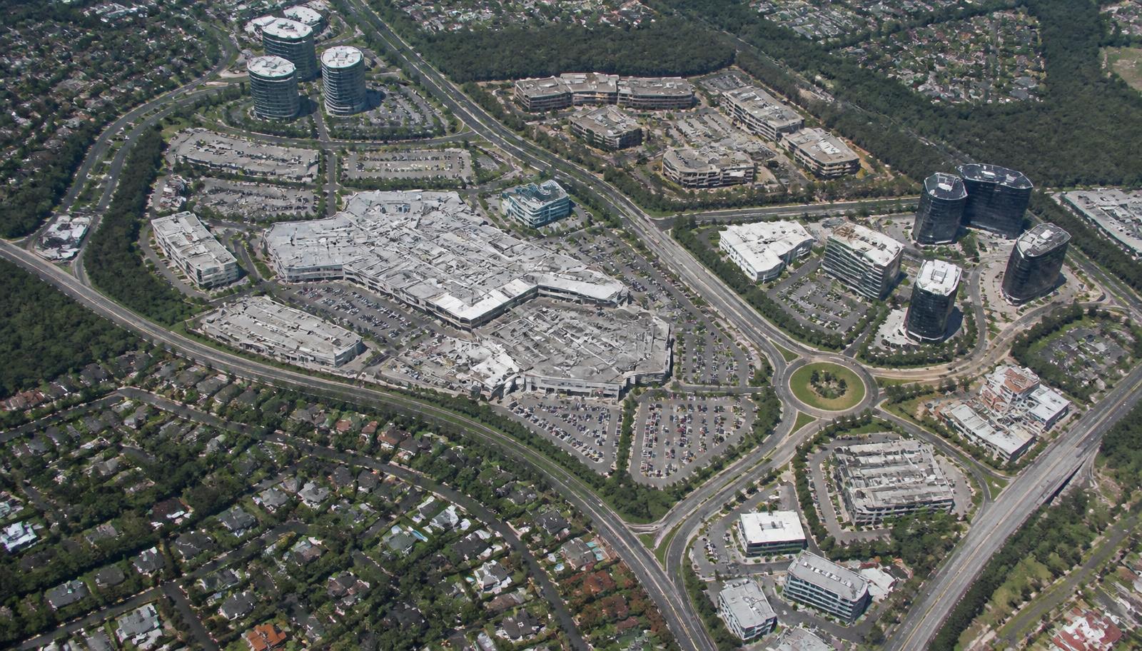
The Map of SouthPark Charlotte
A schematic orientation to SouthPark’s neighborhoods and roads, with a direct route to the live Google map when you need directions.
This is an editorial schematic, not a navigation map. Positions and distances are illustrative. For current directions and business details, use the live map.
Open live Google MapsAll map destinations (31)
- SouthPark MallAnchors
- Phillips PlaceAnchors
- Specialty Shops on the ParkShopping
- Del Frisco's ↗Restaurants
- The Capital Grille ↗Restaurants
- The Palm ↗Restaurants
- Toscana ↗Restaurants
- Fig Tree ↗Restaurants
- Good Food on Montford ↗Restaurants
- The Ballantyne ↗Hotels
- AC Hotel SouthPark ↗Hotels
- Hampton Inn at Phillips Place ↗Hotels
- Renaissance SouthPark ↗Hotels
- Quail Hollow Club ↗Country Clubs
- Carmel Country Club ↗Country Clubs
- Myers Park Country Club ↗Country Clubs
- Charlotte Country Club ↗Country Clubs
- Symphony Park ↗Parks
- Park Road Park ↗Parks
- Freedom Park ↗Parks
- Mint Museum Randolph ↗Culture
- FoxcroftEstate Neighborhoods
- Olde FoxcroftEstate Neighborhoods
- Morrocroft EstatesEstate Neighborhoods
- Quail HollowEstate Neighborhoods
- Barclay DownsRefined Enclaves
- Beverly WoodsRefined Enclaves
- Sharon WoodsRefined Enclaves
- MontibelloRefined Enclaves
- Governor's SquareRefined Enclaves
- Morrison PlaceCondominium / Mixed-Use
Where SouthPark Sits in Charlotte
SouthPark is a district on Charlotte's south side, roughly six miles from Uptown, built outward from the corner of Sharon Road and Fairview Road. It is not an incorporated town and has no city-hall boundary of its own; it is a commercial core with a ring of residential neighborhoods that grew around it after SouthPark Mall opened in 1970 on what had been Morrocroft dairy farmland.
That history explains the shape of the map. The retail and office core is dense and walkable in a few blocks around the mall. Immediately beyond it, the grid loosens into wide lots, mature hardwood canopy and curving residential streets that predate or followed the mall by a decade. There is no gradual transition zone — you leave four-lane retail frontage and are on a shaded residential street within two turns.
What Counts as SouthPark
Ask three Charlotte residents where SouthPark ends and you will get three answers. The working definition most brokers, residents and city planners use in practice:
| Edge | Boundary | What's beyond |
|---|---|---|
| North | Runnymede Lane / Woodlawn Road | Myers Park and Freedom Park |
| East | Providence Road | Eastover, Cotswold and Foxcroft's eastern streets |
| South | Carmel Road / Fairview's southern reach | Carmel, Quail Hollow and Beverly Woods |
| West | Park Road | Madison Park, Park Road Park and Montford |
Neighborhoods on those edges — Foxcroft, Quail Hollow, Beverly Woods, Cotswold — are described as SouthPark by some listings and as their own districts by others. Both are defensible. The full neighborhood index treats each one on its own terms rather than arguing the line.
The Four Roads That Carry the District
Almost all SouthPark movement happens on four arterials. Understanding which one you are on is most of the orientation problem solved.
| Road | Direction | What it connects |
|---|---|---|
| Fairview Road | East–west | Park Road to Providence Road, straight through the retail core |
| Sharon Road | North–south | Runnymede Lane to Carmel Road, past every mall entrance |
| Park Road | North–south | Woodlawn to Pineville along the western edge |
| Providence Road | Northeast–southwest | Uptown and Myers Park down toward Ballantyne |
| Morrison Boulevard | Spur | Office towers, Phillips Place and hotel frontage |
| Barclay Downs Drive | Internal | Residential connector between Fairview and Morrison |
The Fairview and Sharon intersection is the single busiest point in the district and the reason most local driving advice reduces to: approach the mall from the side you intend to park on, not the side you happen to be coming from.
What Sits Where on the Map
SouthPark Mall, Phillips Place, Symphony Park and Specialty Shops on the Park — the walkable retail, dining and cultural center, plus the office towers along Morrison Boulevard and Barclay Downs Drive.
Foxcroft, Olde Foxcroft, Morrocroft Estates and Quail Hollow hold the largest lots and the deepest tree canopy, generally west and south of the core.
Barclay Downs sits closest to the mall and is the most genuinely walkable residential pocket. Sharon Woods, Montibello and Governor's Square follow.
Myers Park and Eastover run along the Providence corridor toward Uptown — older, more historic, and frequently grouped with SouthPark in relocation searches.
A ranked read of these, by price tier, lot scale, walkability and schools, is in the best neighborhoods in SouthPark.
ZIP Codes on the SouthPark Map
| ZIP | Covers | Note |
|---|---|---|
| 28211 | Core, Foxcroft, Barclay Downs, eastern streets | The ZIP most associated with SouthPark |
| 28210 | Southern and western edges, Quail Hollow, Beverly Woods | Extends well past the district |
| 28209 | Northern approach toward Park Road and Madison Park | Shared with Myers Park's western side |
| 28226 | Southern extension toward Carmel and Ballantyne | Often marketed as SouthPark adjacent |
ZIP boundaries are postal-delivery lines. They do not set school assignment, tax rates or neighborhood identity — a point worth checking before buying on that basis. The ZIP code breakdown covers what each one actually contains.
Planning a Route from SouthPark
Routes and travel times change with congestion, road work and where within the district your trip begins. Use the live Google Maps link above for current directions rather than treating the schematic as a street map. Providence Road and Park Road are two approaches toward Uptown; the airport route depends on conditions at departure.
If You Meant the Inside of the Mall
This page maps the district. If what you need is the shopping center itself — which anchor sits at which end, which entrance opens onto which road, which free deck serves which wing, and how the designer concourse is arranged — that is a different map entirely.
Read the SouthPark Mall map and wayfinding guide, or the complete store directory if you are looking for a specific house.
Common Questions About the SouthPark Map
SouthPark sits roughly six miles south of Uptown Charlotte, centered on the intersection of Sharon Road and Fairview Road. The commercial core is built around SouthPark Mall, with residential neighborhoods radiating outward in every direction.
There is no single legal boundary — SouthPark is a district, not an incorporated town. In everyday use it runs from Park Road on the west to Providence Road on the east, and from Runnymede Lane on the north to Carmel Road and Fairview's southern reach.
Four arterials carry nearly all district traffic: Fairview Road east to west, Sharon Road north to south through the retail core, Park Road along the western edge, and Providence Road on the eastern side toward Myers Park and Eastover.
No. SouthPark Mall is the shopping center at the center of the district. The district is the surrounding several square miles of neighborhoods, offices, parks and restaurants. For the inside of the shopping center, use the SouthPark Mall map instead.
28211 covers most of the core and eastern side, 28210 the southern and western edges, 28209 the northern approach toward Park Road, and 28226 the southern extension. Postal boundaries do not determine school assignment.
Both Uptown Charlotte and Charlotte Douglas International Airport are reachable by car, but travel times vary considerably with traffic, route and departure point. Check live directions for a current estimate.